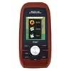
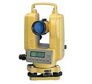
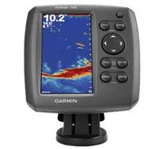
Detail Gps Magellan Triron 300, Magellan GPS Triton 300
ach Triton 300 comes with: Unit, USB Cable, Vantage Point Software, Manual and a One-Year Warranty.
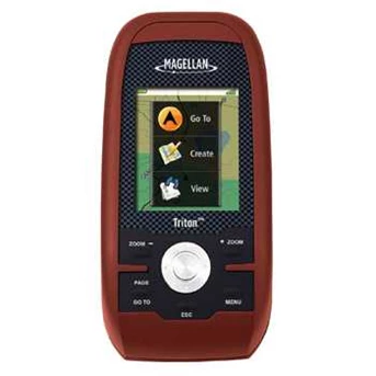
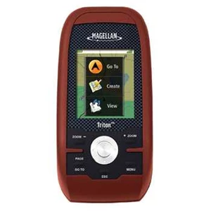
Unit Size: 4.65" H x 2.16" W x 1.22" D
Weight: 6.6 oz. with Batteries
Magellan Triton 300 Special Features
* 10 MB of storage for additional National Geogrphic TOPO! Maps.
* SiRFstarIII WAAS GPS system receiver for increased accuracy and top notch tracking.
* 16 Color backlit LCD Display is viewable in any lighting condition.
* 2 AA batteries power the unit for up to 10 hours.
* Built-in basemap of North America with Worldwide Geographic Boundaries.
The Triton 300 is part of Magellan’ s groundbreaking Triton Family of handheld GPS units. With an updated design and easy to use operation, the Triton 300 is a must have unit for any outdoor adventure. The generous 2.2” color display is sunlight viewable and is built into a rugged, waterproof case. The highly sensitive SiRFstar III WAAS GPS receiver will provide unsurpassed satellite tracking, even in heavy tree cover. Powered by just 2 AA batteries, the Triton will run for up to 10 hours on one set.
The Triton 300 is also compatible with National Geographic TOPO! maps. National Geographic Topo! State Series Maps are the first software to offer 1: 24, 000 scale mapping for the entire US that can be downloaded into a handheld GPS. These maps are downloadable onto the Magellan Triton Series handheld GPS where you can view your location on the crisp 24k USGS maps in real time. This software will also allow you to view lat/ lon or UTM grids, view trail profiles along with elevation gains or losses and find trails, parks, summits and campsites all on your PC. You can even customize the maps by adding your own notes and photos. The detailed maps can be loaded the Magellan Triton 300’ s 10 MB of onboard storage.
The Triton 300 is so easy to use you will not need a user’ s manual. The pre-loaded map database includes detail for North America, ing produ as well as geographic boundaries worldwide. Other features include best times for fishing and hunting, sun and moon phases, and vertical profiles
Harga Paling Baik Hub:
Riyan Apriyani:
022-71302555
081322001525
Fax:
022-7800582
email. riyan@ indogeotech.com
www.geonet29.indonetwork.co.id
www.indogeotech.com
Tampilkan Lebih Banyak